Social media has drastically altered the concept of information contribution and dissemination by empowering the general public to publish and distribute user-generated content. The information conveyed through such media is thematically diverse, ranging from important (e.g. reporting an earthquake) to mundane (e.g. pop culture references). However, this information often contains a geospatial component: a tweet on a specific topic may have a set of precise coordinates associated with it, so that we know the author’s location when it was posted.
Similarly, a Flickr image or a YouTube video often have geolocation information associated with them, offering us the same insight on their point of origin. All this represents a brand new type of geospatial information: while traditional geospatial information was available for example as maps or satellite imagery, we now have geospatial information embedded in text or in the trends of images posted in social media sites. These are manifestations of people acting as sensors: something is peaking their interest and they post about it.
While their format ranges from SMS-like messages limited to 140 characters (Twitter) to images (Flickr) and video (YouTube), these social media feeds share a common nature: they are real-time published expressions of a society’s cultural and societal interests. Harvesting and analyzing their content can offer unparalleled insight on sociocultural structure and its dynamics. For example, it allows us to:
- identify the structure of social networks and their distribution in space (e.g. the distribution of a community formed around a specific topic);
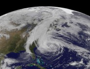
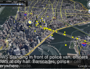
- map the manner in which ideas and information propagate across space in a society (e.g. people reacting to an earthquake);
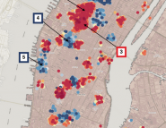
- map the spatial footprint of people’s opinions and reaction on specific topics and current events at near real-time rates (e.g. observing how fast people react to political or sports events); and
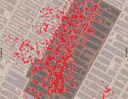
- identify emerging socio-cultural hotspots (e.g. popular gathering places).